
Spanning 3,000 square miles across some of the most diverse landscapes in Pennsylvania, the Laurel Highlands is home to scenic views, lush forests, rushing rivers, and roaring waterfalls. Let’s take a closer look at some of the stunning natural wonders in the Laurel Highlands. Perhaps you will recognize a few gems and discover some new must-sees.
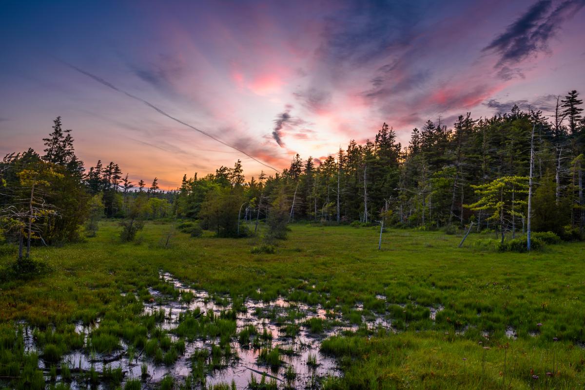
Spruce Flats Bog, Laurel Summit State Park
Make a stop at Spruce Flats Bog, a unique vantage point and home to beautiful plant life, including carnivorous plants. Home to unique plants not usually found in this region, Spruce Flats Bog is shrouded in geological mystery. Bogs are typically not found at such high elevations. But this bog sits in a rock depression at 2,720 feet above sea level. Geologists believe that Spruce Flats probably wasn’t formed by glacial movement, but by extreme weather. The water in the bog isn’t fed by natural springs, but by rain and snowfall, making the water a little stagnant and very acidic. Here you’ll find familiar flora like mountain laurel and rhododendron, as well as cranberries, St. John’s wort, grasses, and even carnivorous sundew and pitcher plants.
The less than a half a mile stroll from the parking area at Laurel Summit ends at a deck overlooking the 28 acres of swampy and moss-covered land. This region is a great place for bird watching.
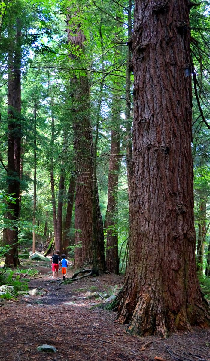
Hemlock Grove at Laurel Hill State Park
Laurel Hill State Park is the perfect destination for winter sports, family fun, hiking, wildlife and bird watching and camping during any time of year. Seventy-five years ago, the Civilian Conservation Corps revived the landscape after heavy timbering and the only untouched area is the Hemlock Trail Natural Area. The hemlocks are at least 200 years old and measure up to three-and-a-half feet in diameter. Take a peaceful trek on the 1.6-mile Hemlock Trail loop, which leads you along the banks of Laurel Hill Creek and through the grove of stately towering trees.
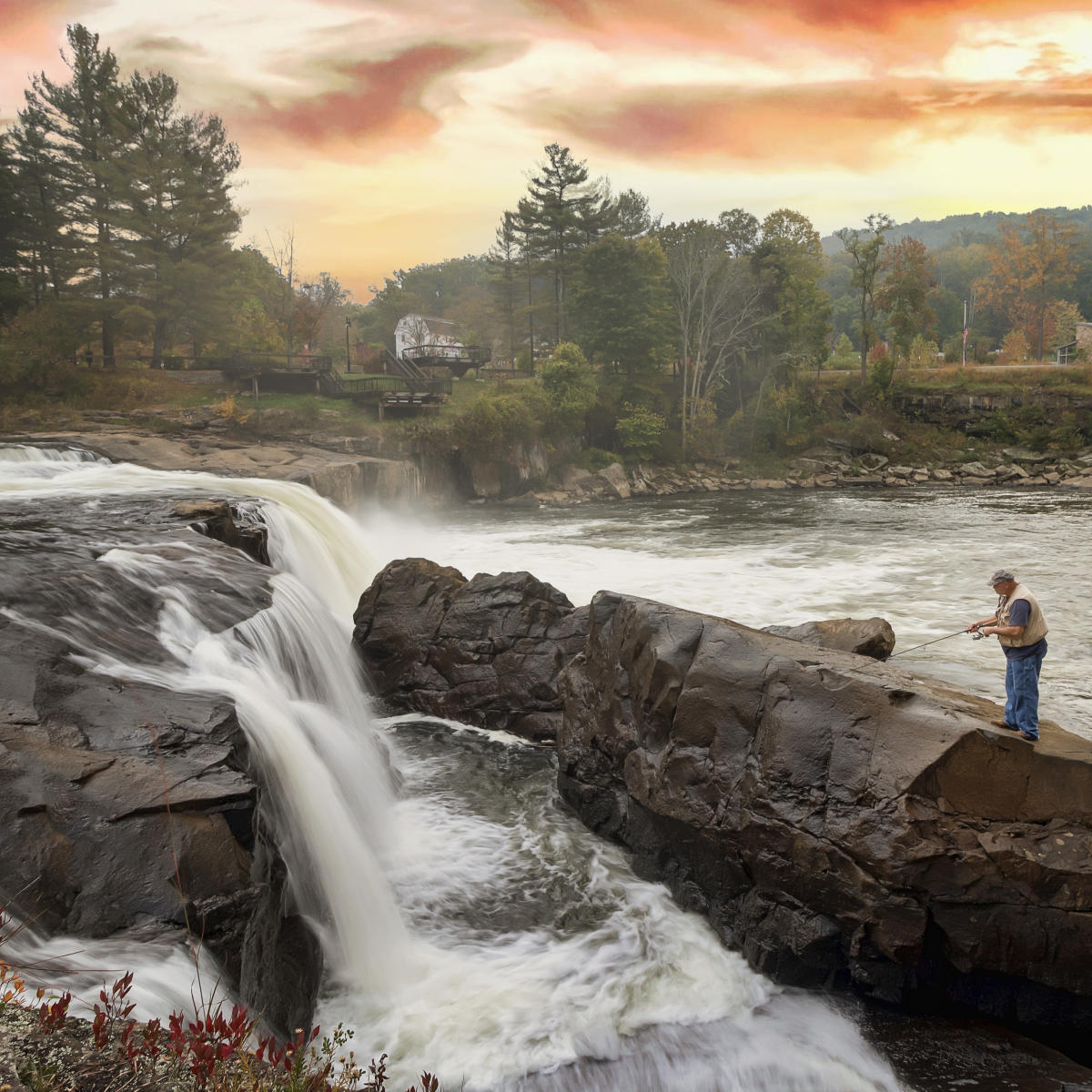
Ohiopyle Falls, Ohiopyle State Park
Ohiopyle Falls, one of many waterfalls in Ohiopyle State Park, features a 20-foot drop of powerful rushing water that spans the entire width of the Youghiogheny River. Visitors can easily access the falls by parking on the main road in town or in the Laurel Highlands Falls Area Visitor Center parking lot. On your way to the observation deck, read some of the interpretive signage about the history of whitewater and the falls, including the story of George Washington’s run-in with the powerful river. Ohiopyle Falls can also be viewed from the opposite side of the river by taking a short hike on the Ferncliff Trail.
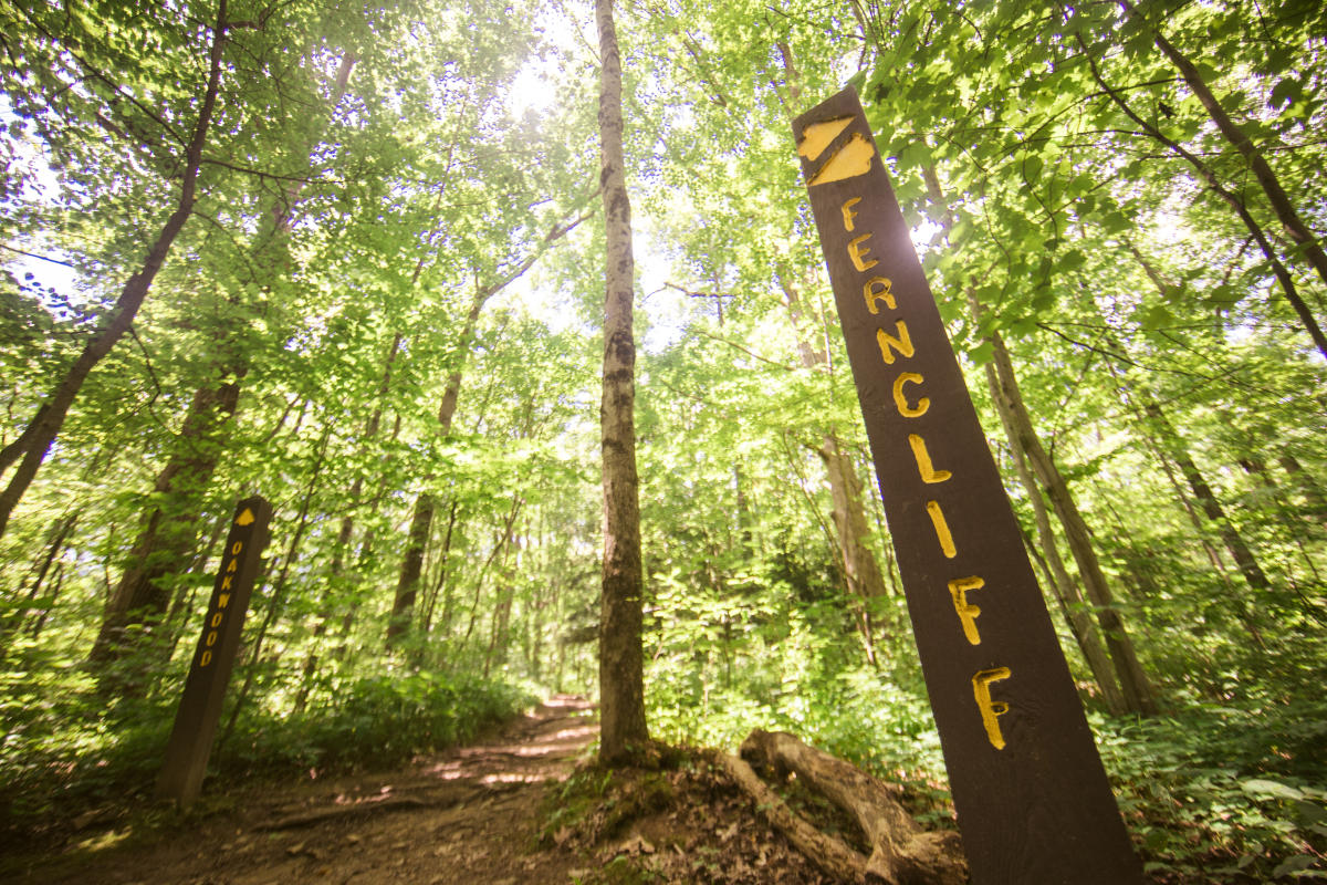
Ferncliff Peninsula, Ohiopyle State Park
Encircled by the Youghiogheny River, the 100-acre Ferncliff Peninsula in Ohiopyle State Park is an exceptional habitat for many rare and interesting plants. The Youghiogheny River flows from the south to the north, picking up seeds in Maryland and West Virginia and leaving them at Ferncliff, north of their usual growing range. Here the deep river gorge is a bit warmer than the surrounding area, allowing these southern plants to survive.
Recognized for its botanical diversity for more than 100 years, the peninsula was declared a National Natural Landmark in 1973.
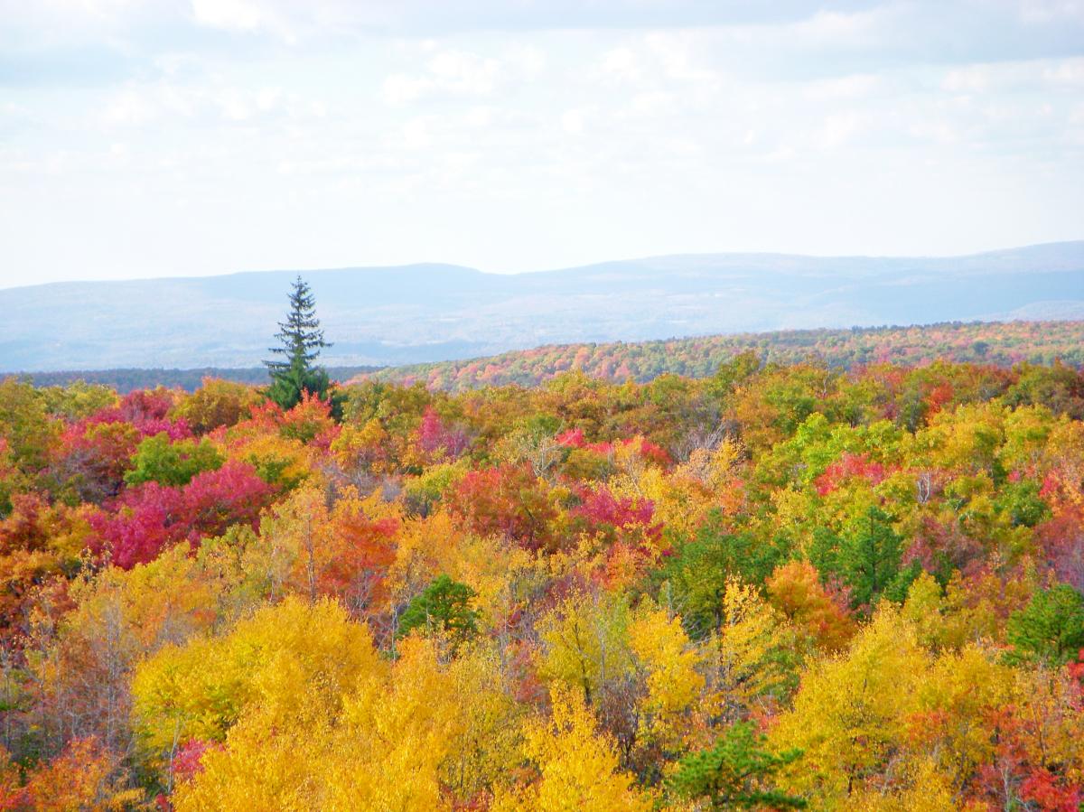
Mount Davis, Forbes State Forest
The highest point in Pennsylvania is located in the Laurel Highlands! Mount Davis, located in Forbes State Forest in Somerset County, is situated 3,213 feet above sea level on the crest of a 30-mile ridgeline. Adventurers will find a large parking lot off of Mount Davis Road and can walk about 100 yards to the peak, making it easily accessible by car. The expansive view from the summit is absolutely breathtaking, but feel free to climb to the top of the nearby observation tower for a better view of the rolling hillsides and picturesque mountains.
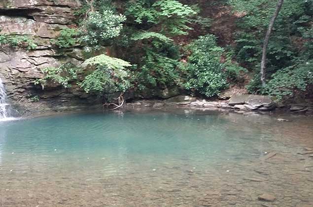
Blue Hole, Forbes State Forest, Blue Hole Division/Barron Tract
Not too far from Cole Run Falls, you will find Blue Hole, a stunning sight for sure. The water has formed a deep hole within the stream where the water appears blue because of the depth and the stones over which the water flows.
For added adventure, check out the remains of the Civilian Conservations Corps camp at nearby Fall Run.
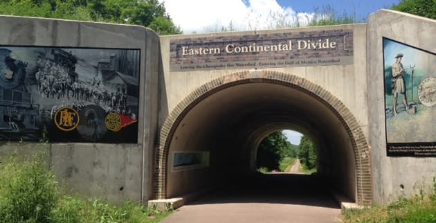
Eastern Continental Divide on the Great Allegheny Passage
The highest point on the Great Allegheny Passage (GAP) at 2,392 feet above sea level, the Eastern Continental Divide can be found at mile marker 23.7, very close to Meyersdale. Pour water on one side of this watershed divide and it flows to the Chesapeake Bay and the Atlantic Ocean. Pour on the other side, it’s headed to the Mississippi River and the Gulf of Mexico.
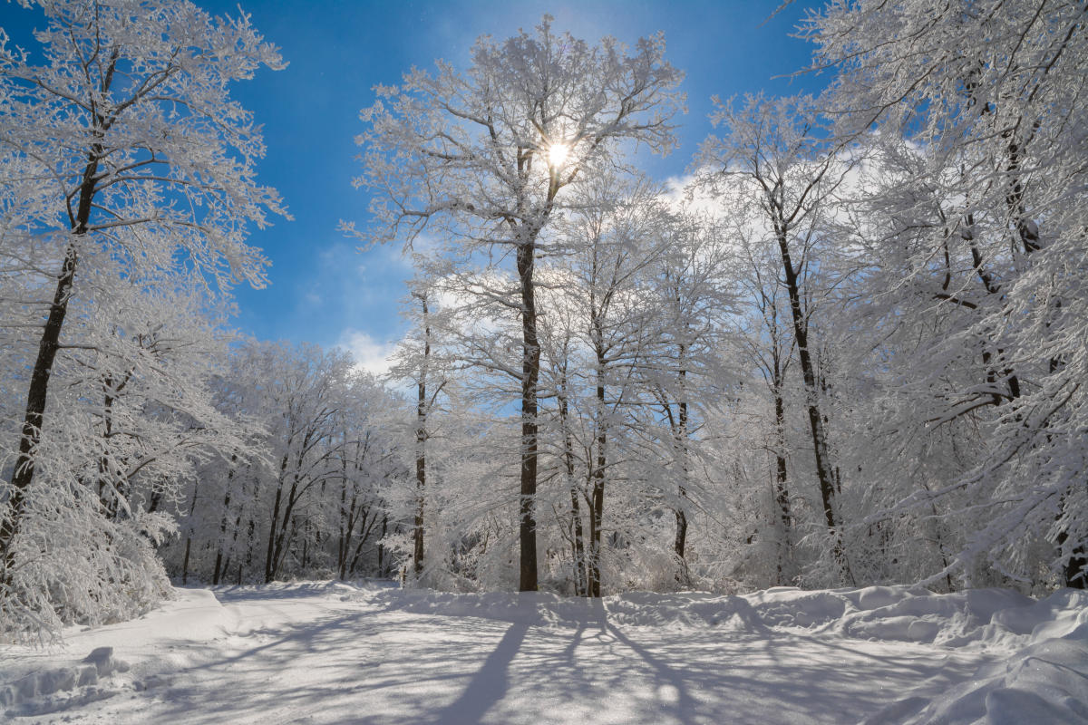
Abundant Snowfall
Alberta Clippers, lake-effect snow, Nor’easters… you name ‘em, we got ‘em here in the Laurel Highlands. The mountain ridges and valley areas not only create a beautiful landscape but a diverse environment, ripe for snow. Western-facing ridges are a bulls-eye for lake effect snowstorms coming from the west and Lake Erie. On average, the highest elevations of the region receive about 138 inches (11.5 feet) of snow between late October and early April. Only our neighbors along Lake Erie can rival the Laurel Highlands for the highest totals in the state.

