A few weekends ago, we decided to explore the birth of a nation by traveling along the National Road through the Laurel Highlands.
The National Road – modern-day U.S. Route 40 – was the first federally funded highway in the U.S. and set a precedent for a national highway system and future public works projects. Beginning in Cumberland, Md., the route passes through the Cumberland Narrows – once one of only a few navigable routes across the Appalachian Mountain Range – before continuing northwest into Pennsylvania, across the Allegheny Mountains and into the Ohio River Valley. The route’s earliest forms were buffalo trails and Native American footpaths. In the mid-1700s, Maryland frontiersman Thomas Cresap and Delaware Chief Nemacolin led an expedition to widen the trail for freight and trade into the Ohio Territory. In 1754-1755, Lt. Col. George Washington and Maj. Gen. Edward Braddock widened Nemacolin’s Trail further during their failed campaigns to drive the French from Fort Duquesne in what is now Pittsburgh.
In 1806, the Jefferson Administration approved plans to build a multi-state national highway from Cumberland westward to open settlement and trade into the Ohio River Valley and the Midwest. Following the route set forth by Nemacolin, Washington, and Braddock, construction on the National Road began in 1811 and reached Wheeling, W.Va. (then Virginia) in 1818. From there, the highway continued across Ohio, Indiana and nearly all of Illinois before funding for the project ran dry in the 1830s.
 From the late 1810s to the 1850s, the more-than 600-mile National Road served as a gateway to the west as the main route from the east coast to the U.S. interior. Today 90 miles of the highway – sometimes referred to as the National Pike or the Cumberland Road – pass through southwestern Pennsylvania, including more than 40 miles in Somerset and Fayette counties in the Laurel Highlands, which was the focus of our exploration on this particular weekend.
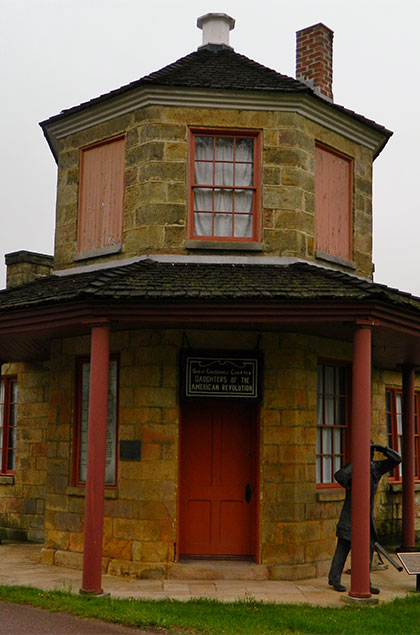
Traveling from east to west as settlers would have in the 19th century, our first stop was at the Petersburg Toll House along Old Route 40 in Addison. When the National Road became too expensive to maintain in the 1830s, the federal government turned maintenance over to each individual state. Maryland, Pennsylvania and Virginia turned the highway into a toll road and constructed tollhouses every 15 miles to collect money to pay for the upkeep of the heavily traveled route.
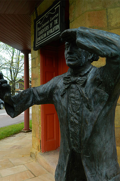 Constructed in 1835, the Petersburg Toll House was known as Gate No. 1, the first tollhouse in Pennsylvania across the Mason-Dixon Line. Now one of only three remaining tollhouses along U.S. 40, the structure serves as a museum, open by appointment, and is owned by the Great Crossings Chapter of the National Society Daughters of the American Revolution.
After leaving Addison, we continued westward, crossing the Youghiogheny River Lake and passing centuries-old inns, houses and other structures on our way to our next destination, Fort Necessity National Battlefield.
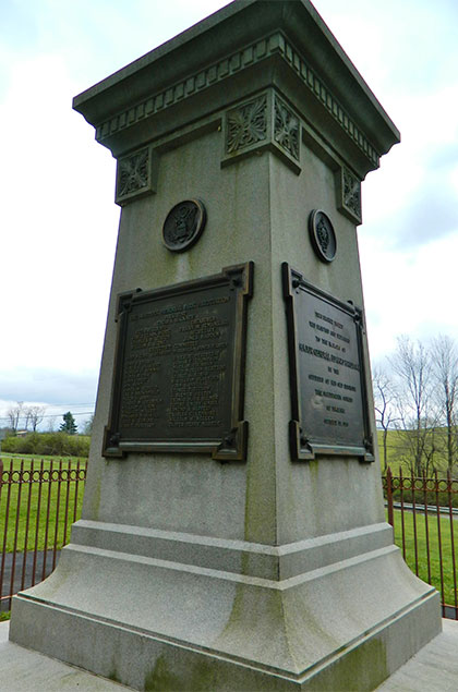 Inside the site’s impressive Interpretive and Education Center, we learned how precursors to the French and Indian War – and the worldwide Seven Years War – were fought in the Laurel Highlands when a young, 22-year-old Washington led a failed attempt to push the French from Fort Duquesne at the forks of the Ohio River in the spring of 1754. Following a controversial skirmish at nearby Jumonville Glen, Washington suffered defeat at his “fort of necessity” and was forced to retreat. He returned the following year, under the command of the somewhat inexperienced Braddock, in another attempt to force the French from Fort Duquesne. Again the British were defeated, suffering more than 900 casualties, including Braddock, whose grave is marked by a large monument along the highway 1 mile west of Fort Necessity. (Incidentally, the British finally forced the French from Fort Duquesne in 1758 under the leadership of Gen. Edward Forbes, whose march westward helped shape the Laurel Highlands’ other historic highway, U.S. Route 30 – a.k.a. the Lincoln Highway.)
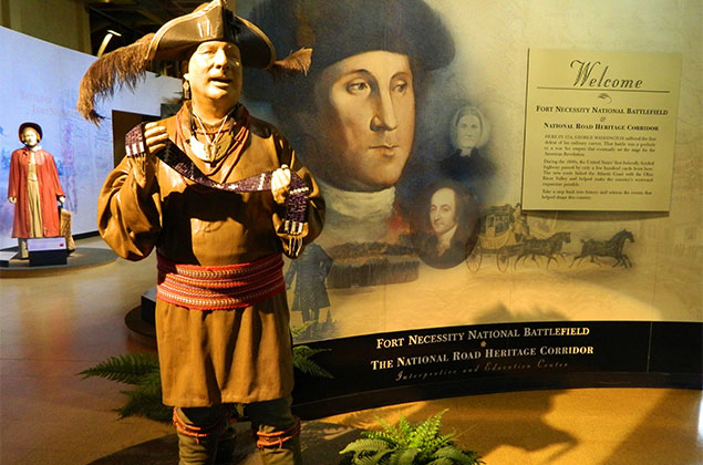 In addition to offering a reconstructed version of Fort Necessity, interactive displays and 5 miles of walking trails, Fort Necessity National Battlefield also details the history of the National Road. During our visit, we traveled back through time and learned about the highway’s construction, its decline during the industrial, railroading age and its rebirth as an automobile “motor touring” highway in the 20th century. The Mount Washington Tavern, a former stagecoach stop overlooking the reconstructed fort, is part of Fort Necessity National Battlefield and serves as a museum depicting life along the National Road during its heyday.
 Having known very little about the French and Indian War or the National Road before my visit to Fort Necessity, I left quite impressed and eager for more information on how both affected the history of the U.S. I would recommend anyone with an interest in history visit the National Park Service site.
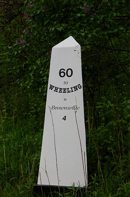
With a better understanding of what British troops and early settlers faced traversing southwestern Pennsylvania in the days before automobiles and other modern conveniences made travel so easy, we continued westward, keeping our eyes peeled for the white obelisk mile markers denoting the byway. Stone markers were initially placed at 5-mile intervals on the south side of the National Road between Cumberland and Wheeling during the highway’s construction, but were later replaced by cast iron markers at 1-mile intervals on the north side of the route in 1835.
 At the top of Chestnut Ridge, we were treated to a stunning view of Uniontown and the surrounding countryside before descending into the valley below. Following Business Route 40, we navigated the streets of Uniontown, once a major center of business along the National Road.
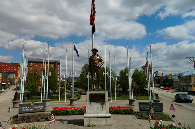
Near the center of town, we stumbled upon the George C. Marshall Memorial Plaza, a tree-lined spot at the intersection of West Main and West Fayette streets near Marshall’s boyhood home. Several statues and the Flags of Nations celebrate his life, and narrative plaques tell Marshall’s story. 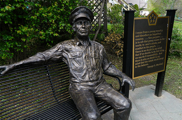 The history and significance of the National Road, which passed through his hometown, was not lost on Marshall as a child and can be linked to his pursuit of a military career. Marshall rose to become a preeminent World War II general, U.S. Army Chief of Staff, Secretary of State and Secretary of Defense, among his other notable achievements and positions. In 1953, he earned the Nobel Peace Prize for his role in developing the post-World War II European Recovery Program (better known as the Marshall Plan). According to History.com, Marshall is one of the most respected soldiers in U.S. history, second only to Washington, another famous George with ties to the region.
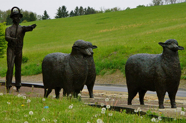
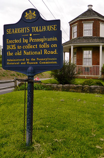 From Uniontown we continued our journey westward, stopping briefly to see the Searight Toll House. The structure is similar in design to the Petersburg Toll House and was also constructed in 1835. Searight Toll House is home to the “Off to Market” sculpture, one of five full-size, outdoor bronze sculptures constructed at specific locations for a National Road Sculpture Tour designed to augment visitors’ educational experiences in learning about the historic highway.
 A few miles from the Searight Toll House we reached our final destination, historic Brownsville on the banks of the Monongahela River. Like Uniontown and other hamlets along the National Road, Brownsville was once a major industrial hub as well as a center for steamboat construction and river freight hauling, eclipsing Pittsburgh in size until the mid-1800s.
From Brownsville, the National Road continues onward through Washington County, into West Virginia and beyond. Though the National Road officially ends in Vandalia, Ill., today U.S. 40 stretches 2,285.74 miles across 12 states from New Jersey to Utah.
Each spring communities along the National Road celebrate the highway’s history and its significance in building our nation. You, too, can join in the revelry during the 43rd Annual National Road Festival May 20-22. Travel back in time with a wagon train, demonstrations, an 1860s baseball game, tours and more. Other modern-day activities, like wine tastings, a 5K walk/run, vendor fairs, live entertainment, fireworks and more, are also part of the weekend-long festivities.

Author
Sheena Baker
Sheena Baker is the communications coordinator for the Somerset County Chamber of Commerce as well as a freelance motorsports journalist. A native of the Laurel Highlands, she serves on the board of directors for the Friends of Flight 93 National Memorial.

